PedalSafe Perspectives
PedalSafe Perspectives is our new blog series highlighting the PedalSafe community’s experiences, insights, and ideas about safer cycling in Roanoke. We’re excited to have Ken McLeod, a PedalSafe founding board member and our former board Chair, kick off the series with his reflections on the upcoming Wiley Drive low water bridge replacement.
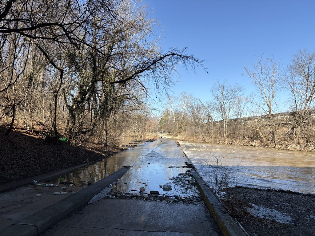
The low water bridge on Wiley Drive connecting Wasena and River’s Edge is going to be replaced and will close for nine months. The good news is that the replacement bridge will be higher and less likely to flood. The bad news is that in the short term, one of the most traveled sections of the Roanoke River Greenway will be closed, severing a key connection point in Roanoke’s protected cycling and pedestrian infrastructure.
The details
- What: Bridge replacement and complete bridge closure
- Where: Wiley Drive low water bridge on the Roanoke River Greenway (between Smith Park and River’s Edge Park)
- Why: The bridge is too low and regularly floods, closing the greenway
- When: TBD
- Greenway detour during construction: The city has stated that “a signed detour will direct Greenway users to cross the Wasena Bridge, travel through Highland Park, connect with Franklin Rd at Walnut, and cross at Reserve to reconnect with the Roanoke River Greenway in Rivers Edge Park”
PedalSafe ROA members have spoken about this bridge closure at City Council meetings several times in recent months, both to ask the city to avoid fully closing the low water bridge during its replacement and to get a better understanding of why the city is choosing to completely close it for nine months. The city’s response in January was that “there is no safe or feasible way to keep the Greenway open at this location while the bridge is being replaced. The existing structure must be removed all at once, and the limited right-of-way leaves no room for a temporary path.”
Problems with the greenway detour
While we don’t know the exact detour route yet, I have several concerns – some that can be addressed, and some that likely can’t.

The detour disrupts protected cyclist and pedestrian travel
Many people use the greenway for its continuous access, safety, and separation from motor vehicles. During the bridge closure, this will no longer be possible: a signed detour does not provide a greenway-like experience. People who bike will have to use roads, some of which are high-volume. People who walk will need to navigate more intersections. Both groups will be forced to travel alongside motor vehicles. This disruption is unavoidable, and it should be a priority to make the detour as safe as possible.
The new Wasena Bridge is not open yet
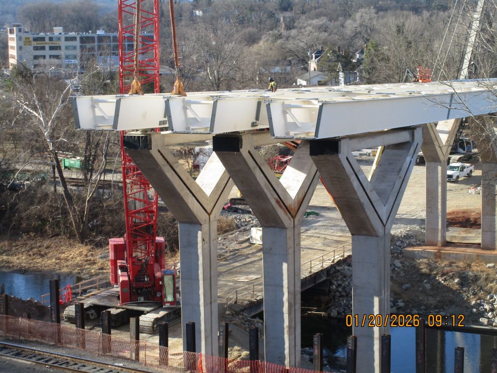
The proposed detour uses the new Wasena Bridge, which is not yet complete. While initially planned to reopen in spring of 2026, it seems likely that the new bridge will not be open until the summer or fall of 2026 given current progress. If that is true, then the greenway closure would occur during the fall, winter, and spring into 2027. Public information on the bridge opening timeline has not been updated since early in the year, making the timing of the project uncertain.
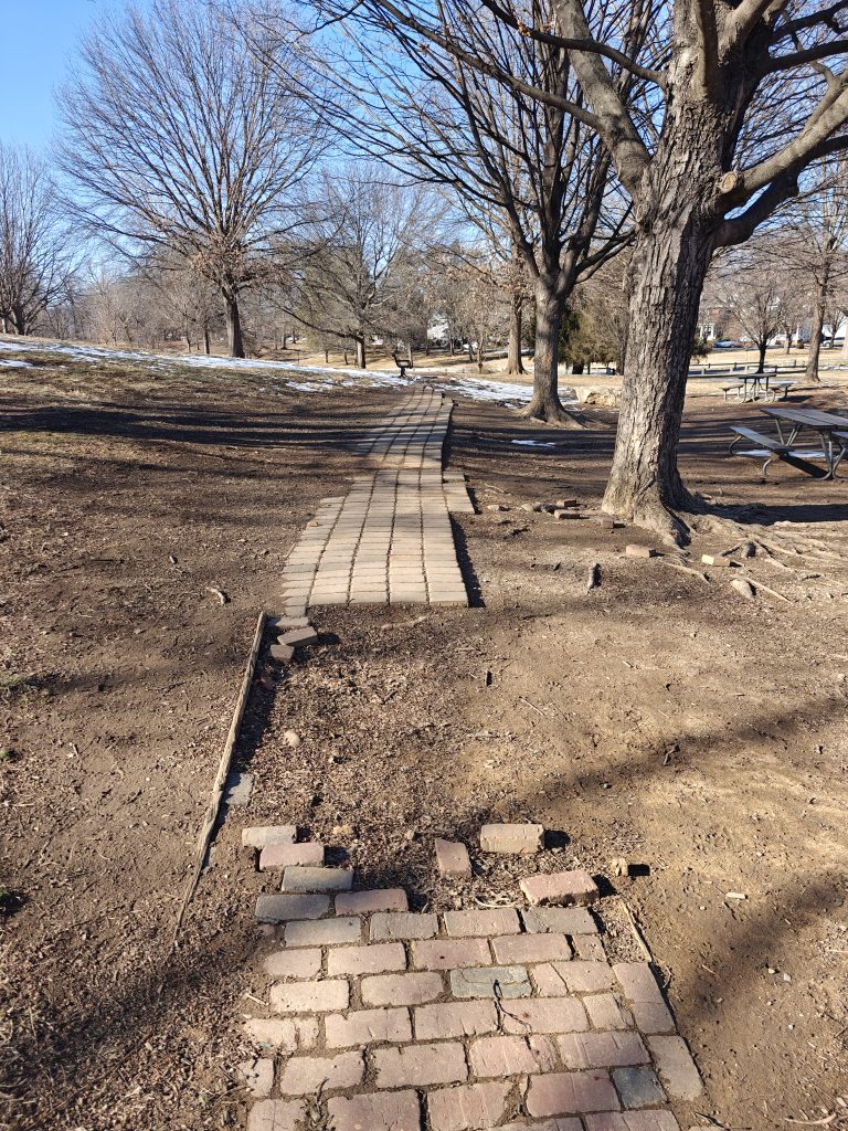
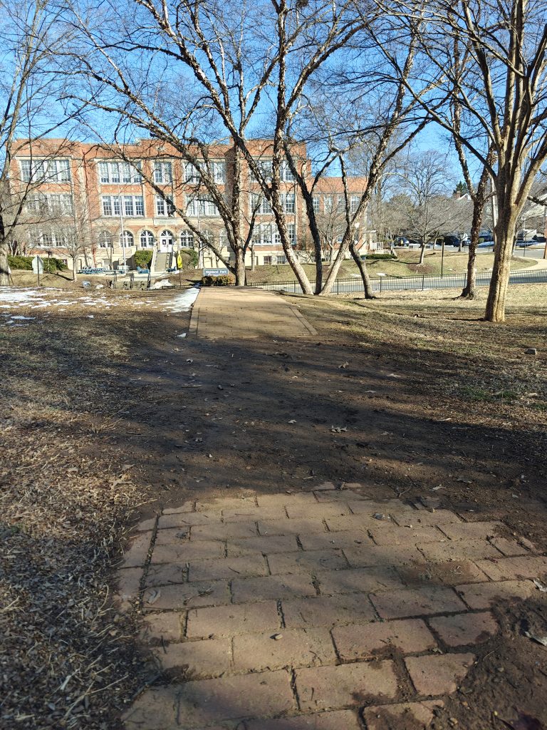
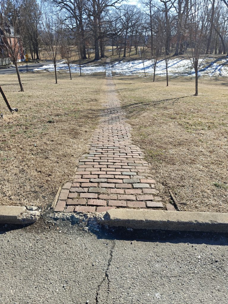
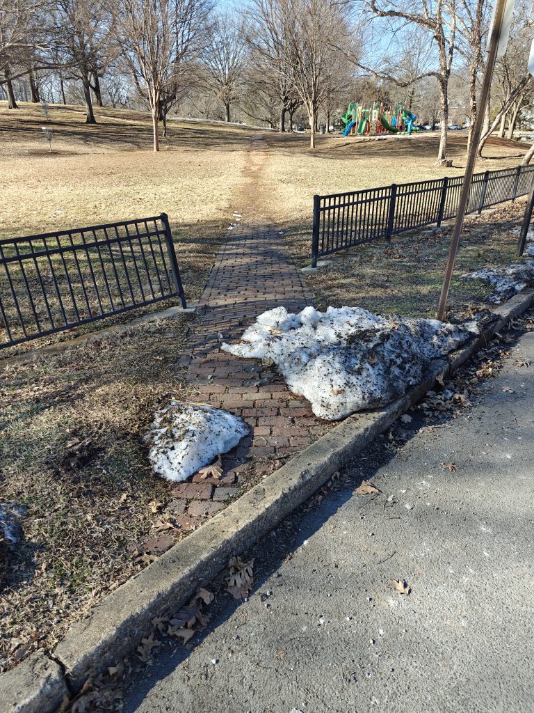
Traveling through Highland Park on wheels is challenging
The planned detour goes through Highland Park, which presents several issues for people who are biking. The paths through Highland Park are narrow and made of brick, often without curb cuts. They are bad for biking, strollers, wheelchairs, and other wheeled vehicles. The city’s explanation of the route does not address an alternative route for bikes.
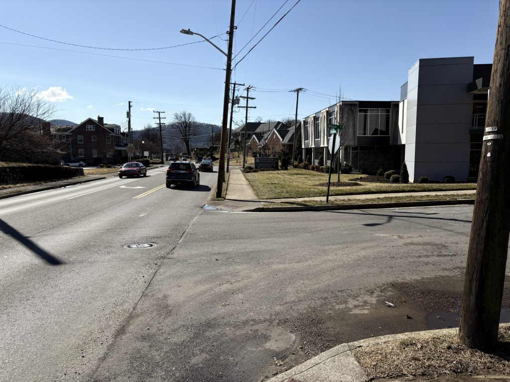
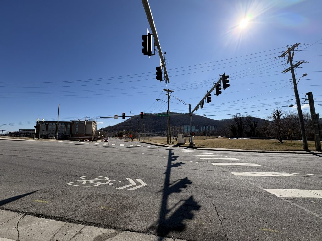
Franklin Road is a high-volume road with insufficient biking and pedestrian facilities
Franklin Road has an average daily traffic volume of around 10,000 vehicles and has a posted speed limit of 25 mph. This volume suggests the need for a bike lane, but there is not one on Franklin between Walnut Ave and the underpass of I-581, where Franklin expands to a four-lane road with a median. Even if the city puts signs or shared lane markings, Franklin Road will not have sufficient biking facilities.
Franklin Road also lacks key pedestrian facilities. All crosswalks along Franklin toward the greenway are unmarked without stop lines for side streets, making it uncomfortable to travel down Franklin towards Reserve as approaching vehicles may obstruct the unmarked crosswalk or may be more likely to roll through stop signs.
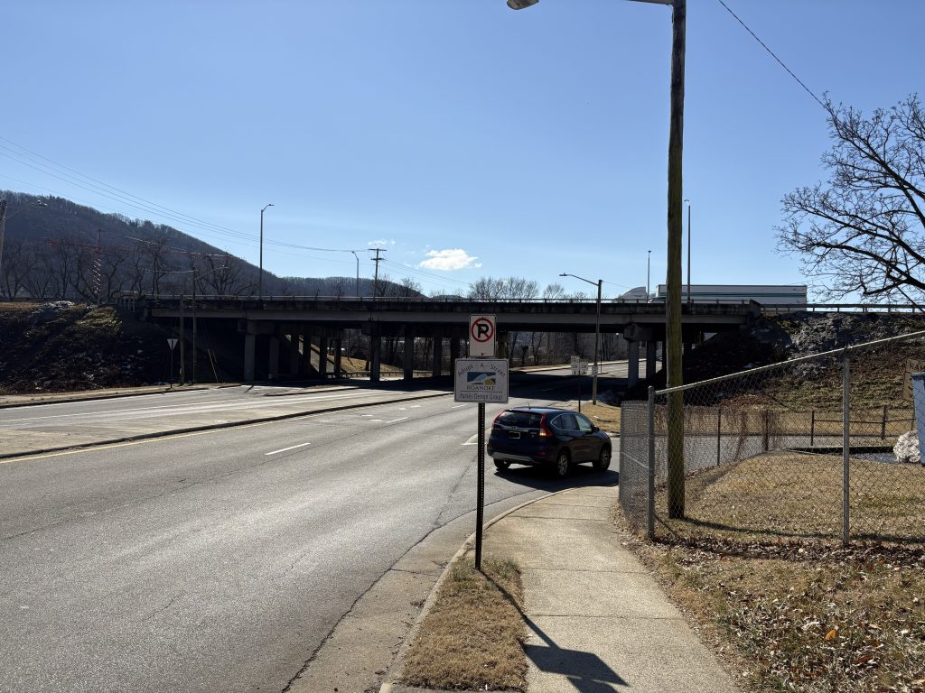
This is especially problematic at the on-ramp for I-581, where drivers are headed downhill and speeding up to join the highway without any markings to draw their attention to people crossing the on-ramp.
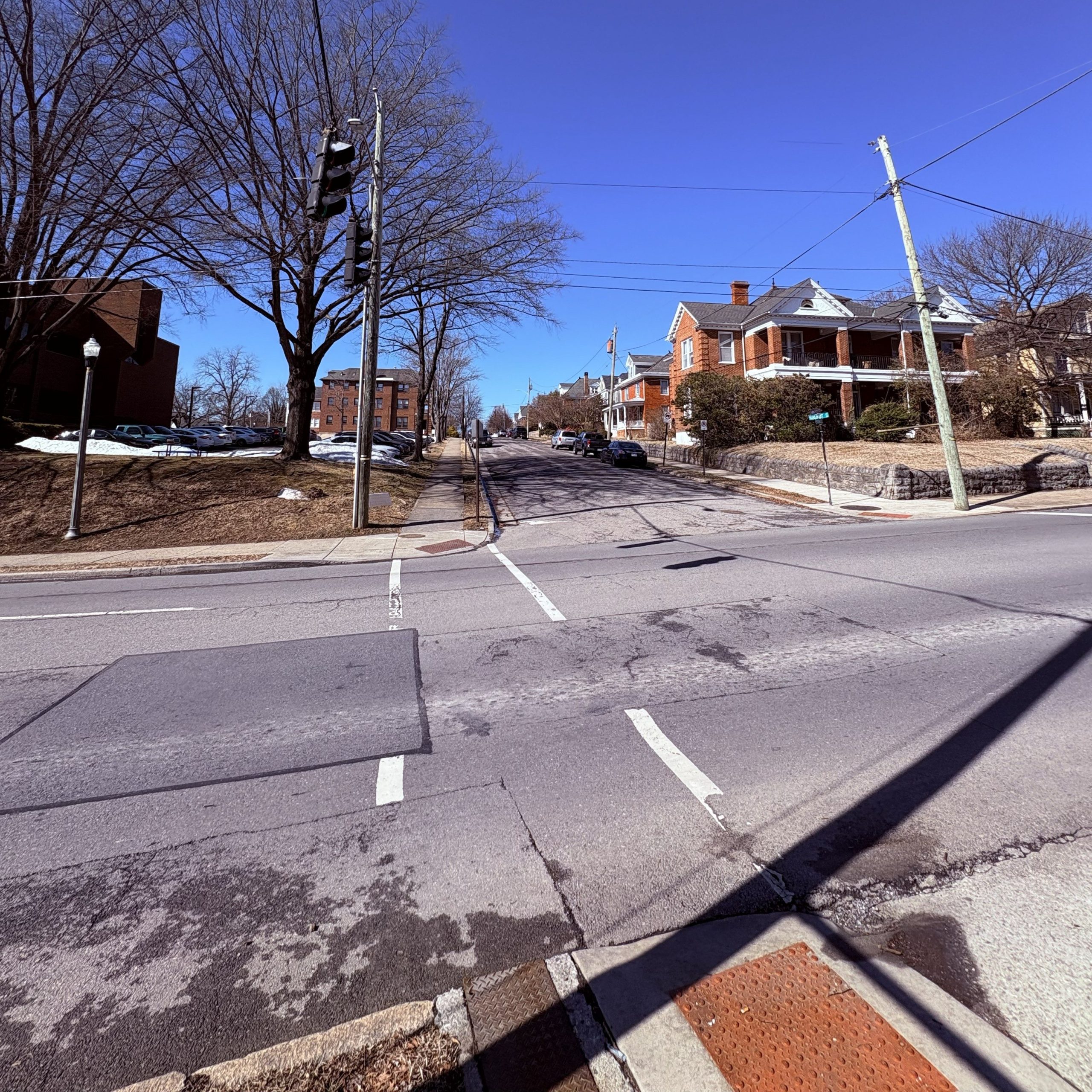
It’s also important to note that while some people will take the proposed detour back to the greenway, it is likely that others will choose to cross Franklin and then continue on Walnut to reconnect to the greenway near Blue Cow Ice Cream – especially those traveling towards Riverland and Bennington.

In this case, while there is a marked crosswalk at the intersection of Walnut and Franklin, there is no pedestrian signal at that crossing. The city should plan for both detours.
Crossing at Reserve is not the safest or quickest way to reconnect to the greenway
The crossing at Reserve involves a large intersection with greenway users crossing at least four lanes of traffic.
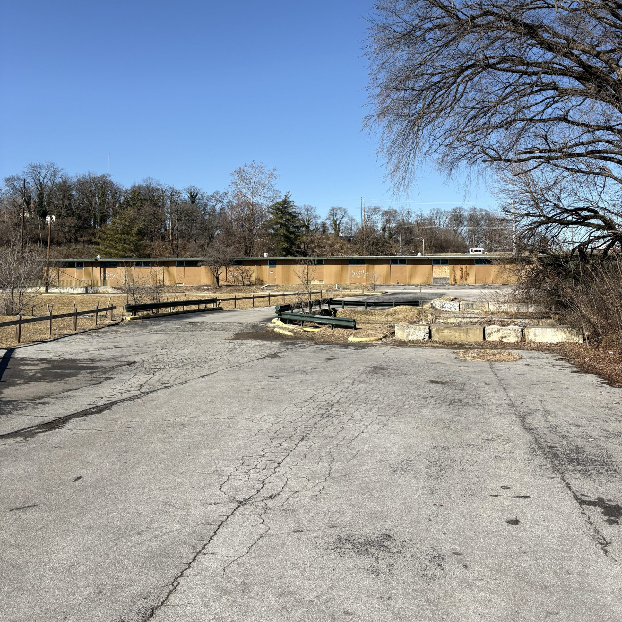
An alternative option is that greenway users instead could continue on the sidewalk along Franklin, going over the Roanoke River and reconnecting to the greenway through the parking lot for the old Ramada Inn that the city turned into green space.

There is already a desire path from that parking lot to the greenway which shows its popularity as a cut-through. This could be a great opportunity to improve that connection.
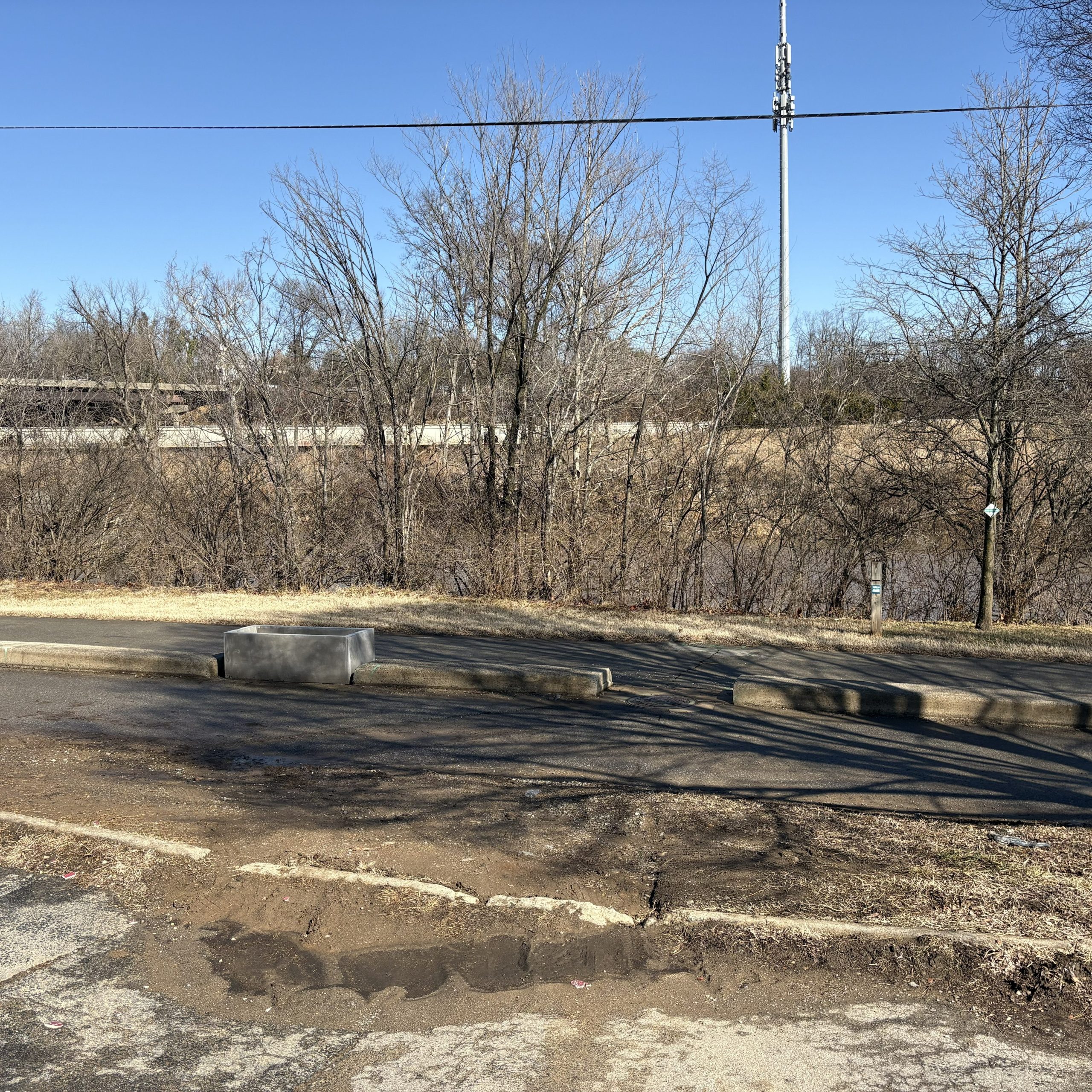
This alternative route is safer because it doesn’t cross any streets. While crossing at Reserve is up to .1 miles shorter (if your destination is the bridge at River’s Edge), it involves waiting for a crosswalk signal that adds significantly more time to the crossing. The city should plan for both routes.
How to make the greenway detour safer
Here’s are a few ways the city can create a safer detour:
- Provide a pedestrian traffic signal at the intersection of Walnut Ave and Franklin Road
- Provide an alternate route for cyclists traveling through Highland Park
- Provide shared lane markings on Franklin Road between Walnut Ave and Wiley Drive
- Provide a cut-through between the old Ramada Inn parking lot and the Roanoke River Greenway
- Designate the sidewalks along Franklin Road on the detoured section as Greenway, so that they are legal to bike on (it’s currently illegal)
- Provide an additional signed detour route along Walnut Ave to the Roanoke River Greenway near Blue Cow Ice Cream for users traveling towards Riverland and Bennington
What happens next
The city says it will release a full plan and ask for public engagement soon. PedalSafe will provide updates when we know more about the bridge closure and greenway detour.
Ken McLeod is a founding board member of PedalSafe ROA and is the Policy Director for the League of American Bicyclists. He regularly rides his bike for transportation in Roanoke and enjoys riding his mountain bike on Mill Mountain and the ups and downs of the Blue Ridge Parkway.
Leave a Reply